Showing posts with label National Parks. Show all posts

Monday, January 31, 2011

White Sands National Monument


Welcome to White Sands National Monument! In the Tularosa Basin of New Mexico is a patch of land which is covered in large dunes of gypsum sand. To have that much gypsum sand is really cool, literally and figuratively!

It's literally cool because unlike the quartz-based sand which most people know about, gypsum does not efficiently turn the sun's energy into heat, so you can walk barefoot in the sand in the middle of summer without toasting your toes.

It's figuratively cool because seeing this much gypsum sand is very rare. Gypsum is water soluble, so most gypsum tends to get washed away by rains. However, here in the Tularoa Basin, there are no natural drainage paths, and so here the gypsum stays.

White Sands National Monument is located inside White Sands Missile Range, where the first atom bomb was tested at the Trinity site! They say that the sand glows at night. (No they don't, I'm just kidding about glowing sand!)


The dunes had a type of beauty which only dunes do. The sand was firm and fine. The dunes were tall. And that combination made it pretty fun to slide down! I stopped at the ranger station and picked up a rental sledding disk. It wasn't as fun as snow sledding, but I could do it in my shorts. :-)


When the rains do come, the waters pool up. The pools soak up the gypsum, but the solution has nowhere to go. So as the gypsum-saturated water dries, a type of crystallized gypsum called selenite gets formed.


Look a that beautiful selenite! Well, OK, maybe "beautiful" is a bit of a strong word, but it was still kind of neat. The selenite was a little bit rougher on my naked feet, but still better than a trek across hot pavement!


The plant life was austere, and beautiful too in a rugged kind of way!


After a fun morning of hitting the slopes of the dunes, I was hungry! Not too far away is a little town in New Mexico called Hatch. Hatch is heaven for chili pepper lovers, because they grow the best in the world! They are known throughout the world for their tasty, spicy peppers, which they celebrate every Labor Day with the Hatch Chili Festival. I just had to try some! I found this funky restaurant called the Pepper Pot for lunch.


Oh my goodness! This was the tastiest red sauce that I ever had on an enchilada! This was drink-it-straight-from-the-pot good! This was I'm-glad-I-don't-live-here-because-I-would-weigh-a-ton-from-eating-it-all-day-everyday good! This was dab-a-little-behind-your-ear-as-perfume good! This was give-me-red-sauce-instead-of-blood-transfusion good! I guess you could say that I liked it. I'll see you next time, if I can manage to leave this table... :-)

Friday, December 31, 2010

Big Bend National Park


Welcome to Big Bend National Park! They say that everything is bigger in Texas, and let me tell you, this is one huge park! But despite its 801,163 acres, the park is ranked 15th in size in the National Park System. (Sorry Texas, your park isn't really bigger.) But even the littlest giant is still a giant, and this park had a lot to offer. However, probably because of its remote location, this park sees a relatively small number of visitors, typically between 300,000 and 400,000 per year.

Big Bend has desert plains, sub-alpine mountains, and 118 miles (189 km) of winding, muddy river banks along the Rio Grande. The diverse landscapes provides for a rich biological diversity. Behind me in the photo above along the north access road is a sign warning of black bears and panthers. Fortunately, I didn't have any run-ins with the more-dangerous wildlife. :-)


I stayed overnight in Chisos Basin campsite, which was truly an ideal spot!


The Chisos Basin was beautiful, and it had the benefit of being at an elevation of 5401 feet (1664 meters). That means that when it's blistering hot in the rest of the park, it's only a bit warm in the basin. And that means it's the coolest place to (legally) camp out in the park, literally!


That notch in the mountain range is known as the Window. Go figure! With Big Bend being so remote, and with Chisos Basin being at a relatively high elevation, the stars at night were awesome! You could really see the Milky Way!


Driving out around Big Bend's 123 miles (197 km) of paved roads was always a delight.


Postcard anyone? :-) What a striking land! Our National Parks are a real treasure!


The rocky spires below are together called the Mule Ears. :-)


Volcanic rock, limestone, and yucca adorned this patch of ground.


I just loved the look of this rocky bluff, with all of its prominent layers. This is near the hot springs in the park. I was on a mission to find these elusive springs.


I never did find the hot springs. :-( But at the time, it was around 100 F (38 C) outside, and clearly very sunny. I opted for a refreshing dip in this nearby cool but shallow stream. Ohhhh, that felt gooooooood!


Hiking out the Chimneys trail, I found one of the local residents. This spider was enjoying a tasty grasshopper snack. I thought the neatest thing was that this spider had built a house for himself out of small twigs. Even spiders can appreciate a little shade in this desert environment.


The desert floor with the Chisos mountains in the background was a beautiful, if inhospitable view. I loved the tall, straggly arms of the ocotillo plant, which you can see on the left side of the photo.


This was such a cool rock! Just look at all of those layers! Those layers tell a story. Was this rock formed from the sediment of some ancient pond? Did it come from silt deposits along a river bed? And how did this rock get here in the middle of the desert? Geologists would have a field day in this park!


There it is, the Rio Grande. It's not look that grand at the moment. The park's boundary officially at the deepest channel in the river. So in this one photo you see two countries! The land really doesn't look all that different on the other side. ;-)


On the western end of the Santa Elena canyon, with an "easy" hiking trail to see such sights as this boulder chock full of fossilized shells. I say "easy" because that's what it says in the brochure. But I think that the massive flood they had in 2008 made access to this trail a little less easy. I had to ford a muddy and mucky, ~2 feet (0.61 m) deep river to get over there.


And here is the view looking out Santa Elena Canyon into Big Bend. On your left, you'll notice the United States. On your right, Mexico.


Towards the end of my visit, I took a very rewarding hike along the Lost Mine trail, which included such wonderful views as this outcropping, which I think is known as Casa Grande. (No relation to the previous post.)


Up at this elevation, the climate is more forgiving, and so the diversity of plant life explodes compared to the desert floor. That doesn't stop the cacti from moving in either!


Impressive, no? I think this is known as Juniper Canyon.


There is something revitalizing about being up among the mountain peaks. I feel, I feel, not so flat. :-)


Lovely flowers in bloom greeted me near this peak.


More of the luscious landscape...


The only large animal I saw in my visit was this deer, who had no problems traversing the steep terrain.


Just beautiful. I don't know why, but I didn't have big expectations for Big Bend. Happily, it turned out to be truly a great place to explore, and a place I wouldn't mind seeing again.


Here I am at the end of the Lost Mine trail. From this vista, you can see the lost mine, which is an adjacent mountain side. The mine itself was not much to see. That didn't bother me, because I was lost in the splendor of this view. Speaking of lost, it's time I get lost in my next adventure. See you then!

Wednesday, June 30, 2010

Zion National Park


Welcome to Zion National Park! It is a rugged and beautiful place in, like so many others locations in southern Utah. Yet Zion has a beauty and majesty all of its own on a gigantic scale which makes it truly a unique treasure.

Established as a National Monument in 1909 by President Taft, the park has been slowly gaining ground, legally speaking. The Kolob Canyon was incorporated into the park boundaries in 1956. Plus, in March of 2009 President Obama added over one-hundred twenty thousand acres of surrounding wilderness to further protect this national treasure.

The region's beauty attracted Native American settlers and nomads thousands of years before European explorers would set foot there. However, a period of droughts and floods in the 11th and 12th century made sustaining life in the valley extremely difficult, and resulted in the Native Americans leaving the scenic valleys for a while. Eventually, the Native Americans returned, and who could blame them?

The age of exploration brought some Europeans, and European-Americans, through the area, but the area wasn't really settled by those of European ancestry until the Mormons moved into the region around 1847. The Mormons had headed west to escape religious persecution, and ended up settling some of the most beautiful lands in the United States. Beautiful, but rather harsh at times. That harsh living may have helped to preserve these lands to be the jewels to us that they are today.

Above, I am posed in front of Timber Top Mountain and Shuntavi Butte (that somewhat cylindrical formation at the end of the range) which is part of the Kolob canyon system. The name Kolob comes from Mormonism, the Book of Abraham, where Kolob is described as being the star closest to God's throne. That gives you an indication of how heavenly beautiful the Mormon settlers considered this place to be!


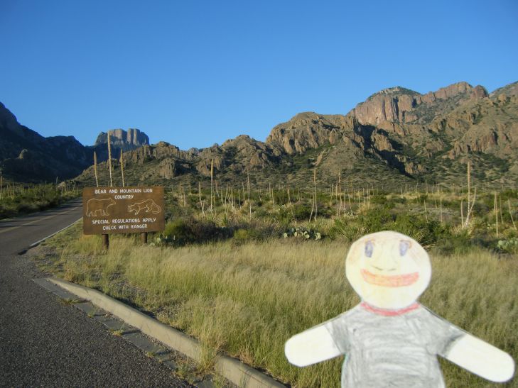
I started my two day journey in Zion National Park in Kolob Canyon, where sheer Navajo sandstone cliff jutted proudly out of the ground in reddish-brown hues.


The Taylor Creek Valley had a nice interpretive trail, if you could interpret it, and maybe if you had a machete!


A scenic drive took you to most of the prominent highlights of Kolob canyon, but there were also several trails available to explore in detail, many of which that did not require trailblazing skills!


There was more than just Navajo sandstone to gawk at, such as the Kayenta formation, which formed as flood plain deposits, trapping basal conglomerates, siltstone, and mudstone into diverse striations. Zion surely has a rich geological history!


I used the La Verkin Creek trail to stretch out my little legs, and to get a different perspective on these giant mountains.


As you can see, this was a very easy trail to follow. It was quite enjoyable too.


That lovely piny smell of juniper often passed through the air.


From the Timber Creek Overlook trail, you could see a mountain off to the west which was steadily burning, and occasionally you could smell a little smoke mixed with that juniper. The dry, arid climate makes the region subject to periodic forest fires.


The next day I explored the Zion canyon part of Zion national park. The name Zion comes from the Bible, where it is often used in connection with Jerusalem in prophesy. The Mormons weren't the only religious groups moving through the area. Many of the formations in Zion canyon were named with their present names by a Methodist missionary by the name of Frederick Fisher.


Highway 9 runs through part of the park, making it one very scenic highway.


As with the Kolob canyon, Zion canyon had monumental mountain peaks with sheer faces.


As you continue on Highway 9, you go through the Zion-Mt. Carmel Tunnel, which is over a mile long! When it was dedicated on July 4, 1930, it was the longest tunnel in the U.S.A. After you exit the tunnel, the landscape seems magically transformed into a rocky wonderland. Strange formations, such as Checkerboard Mesa below, treat the eye around every turn.


Back down in Zion Canyon, I took a hike to the Emerald Pools. It turns out that they were "emerald" because they were full of algae. Ha!


Algae pools aside, the Emerald Pools hike was still fun, partly because of spectacular views of the canyon, like this one. Check out that arch in the rock.


Another memorable hike in the Zion canyon is called the Narrows. I was glad that I was laminated, because I had to walk through the water many, many times on this hike. And it was c-c-cold water! Of course, you don't really notice it after the tenth or eleventh time you cross. :-)


In some stretches along the river, there were no banks on either side, for footsteps or vegetation. Of course, that didn't stop me, and it didn't stop the more persistent plants which would gain a foothold in the nooks and crannies of the rock wall, like this flower.


The walls were towering hundred of feet above my head, making the passage seem even more narrow, but that didn't prevent interesting formations at ground level from being there.


In several spots the walls looking like they had been painted like zebras! In places where the water seeped through the rock wall, it would carry with it dissolved lime, some of which would be redeposited on the face of the wall upon exiting, thus forming the white marks. In those same spots, plants would often grow and their root systems would catch some dirt and organic matter, forming a sort of soil. Not all of the soil gets kept in place, and so you get these black stains running down the walls as well.


Awk! The walls are closing in on me! I guess it's time for me to go. See you next time!