Showing posts with label Arizona. Show all posts

Friday, September 30, 2011

Indian Ruins of Northern Arizona


Welcome to some of the various Indian ruins of northern Arizona!  With me, as a very special guest, is a beautiful lady known as Gram.  Together, we rode many miles over martian terrain, visiting several locations in northern Arizona which had the remains of peoples long since gone.

If you look just over Gram's arm, you can see a cliff in the rock face behind us.  And under that cliff there are a few remaining houses nestled into the eroded gap between rock layers.  These were just one of the many types of dwellings of a group of Native Americans we refer to today as the Sinagua, and this particular location is Walnut Canyon National Monument.

When Spanish explorers had first traversed the lands of Northern Arizona, they found a tall mountain range, which is located to the west of the present city of Flagstaff.  The explorers were amazed that there were no perennial rivers flowing from such tall peaks, and so they called the mountain range the "Sierra Sin Agua."  In Spanish, "sin" means without, and "agua" is water.  An archaeologist by the name of Harold Colton would much later grasp that label as a namesake for the pre-Columbian peoples who had inhabited Northern Arizona, calling them the Sinagua.  For sure, getting water was at times a struggle for these people!


Below you can see the remains of walls which once someone called home.  The rock formation is all limestone in the area of these cliff dwellings.  However, the middle layer where the homes actually are is a slightly different composition, one which is easier to carve out by both man and the elements.


Here you can see what the outside wall of a dwelling would look like fully intact.  The entrance was rather small, and above the entrance an even smaller hole is in the wall.  This small hole was, in effect, the chimney for their cooking and heating fires.  Natural convection would create an updraft, bringing fresh air into the dwelling, while pushing the smoke up and out of the home.

There is evidence that the Sinagua planted their crops on the mesa above their homes.  However, for water, they had to climb all the way down to the bottom of the canyon.  Needless to say, they must have been excellent climbers!  Their only break from the labor of getting water down below would come during winter, where snow deposits could be used instead.


After Walnut Canyon, Gram and I headed to a place called Sunset Crater, and on to Wupatki National Monument.  But we did stop on the way to admire this beautiful field of flowers!


This is one huge lava flow we passed by.  It was great, because I was able to smooth off the rough spots on my feet just by walking on the pumice!


Now, into Wupatki National Monument, where we found multiple Native American dwellings, including this impressive house you could see for miles!  It is called Wukoki.


Here is a closer view.  Pretty reddish orange rocks really stood out against the advancing storm clouds.


It looks like a castle from this angle!


Remember the small window in the photo above?   Well, this is the view from inside that window!  This is one of the few places you can step inside and get a feel for the space where these people lived.  Do you see any water around?  Me neither!  In this settlement, it was several miles to the nearest reliable water source.


It must have taken a long time to collect all of those rocks.  You can do a lot when you don't have TV!


Here is another set of ruins known as Lomaki.  It is suspected that the people abandoned living here sometime around 1100 AD.


These ruins were situated near a relatively small canyon.  They would grow crops in the canyon, relying on the infrequent rain water to collect in the canyons, and carry with it nutrients to help their crops grow.  However, too much water too quickly could put their crops, and their lives at risk.


It's hard to imagine that someone would just decide to plant themselves here, in the middle of unforgiving country.


But they sure built what appeared to be pretty nice houses!


And on to our final set of ruins, known as Tuzigoot.  Have you noticed that these ruins tend to have fun names?  Tuzigoot.  Wapatki.  Wukoki.  :-)  Anyway, you can see that this settlement behind me was built on a hill.  A hill would offer strategic advantages during battles, safety from flooding of the creek which was near this settlement, and, of course, a nice view.  Some things don't change.  :-)


Here I am with my beautiful travel partner.  Notice the difference in the wall structure?  Sure, it's basically the same, but the rocks here are different color from the other settlements, and different shapes.  Tuzigoot is south of Flagstaff near Sedona, so it was entirely different, and probably a lot easier living there.


That easy living probably helps to explain how big Tuzigoot was, having around 77 rooms.  Tuzigoot was also occupied longer, up until around the 1400's.


While the walls were rock, often covered with a plaster originally, the roof structure was made primarily of wood, like what you see here.  Opposite the roof is, of course, the floor, which was mainly unremarkable except for the fact that if these people had a child die young, such as an infant, they would bury the child in the floor of their home with the hopes that the spirit of that child would merge into the next child born there.  I was very careful where I stepped!


And what trip to Native American ruins would be complete without talking about maize?  ;-)  Below you can see the stone tools which the Sinagua people would have employed in grinding the maize into meal.  I know it may sound corny, but that was a mainstay of their diet!  They planted maize and other crops like squash and beans in the lands surrounding the settlement.  That's it for me, so I'll see you on my next adventure!

Thursday, March 31, 2011

Sedona

Welcome to Sedona!  There are some cities you go to, and you look around, and you wonder why in the world anyone would have picked this particular spot to settle.  Not so in Sedona, Arizona.  Ooo, that's fun to say!  Sedona, Arizona, imma gonna, maybe phone ya.  But I digress.  ;-)

Sedona is beautiful!  This valley, set in deep pockets of bold, red sandstone is home to just over 10000 people.  Sedona gets its name from its first postmaster, Sedona Arabelle Miller Schnebly.  Now that's a name!  It was first settled by European-Americans in 1876, when ranchers planted their roots.  Farmers planted their roots a little later, making the valley renowned for its peaches and apples.

Word got out about Sedona's beauty, and so in the 1950's, things started changing.  Vacation homes sprung up.  Tourists started showing up.  Later, artists and other free spirits moved in, captured by the beauty of these lands.  Now, tourism makes accounts for most of the industry in the town, which can make the town seem a bit too commercial.  But that's OK.  Escape is a short hike away!  :-)


At the base of Cathedral Rock, the land just seems to say "Hey, you, climb on up, it will be fun!"


Bright, reddish orange rock, lush green shrubs, clear blue skies...  It's great to be alive!


The flora here varied quite a bit.  In the valleys, scrub trees and oaks cover the floor.  On the higher rocky plains like these, with greater sun exposure and less water collection, the plants look more like what you find in the desert surrounding Sedona.


Loved these rocky, layered spires!


I'm getting closer to the top of Cathedral Rock.  The stone pillars stand proud against the sunbeams.


Didn't I see some of these wiry plants in Big Bend National Park?  Their still kind of cool.


Almost to the top.  Must make it.  Mouth dry.  If only I could drink water.


Do you see the little, itty-bitty whitish speck up near the top of the photo above this massive outcropping?  That's the moon.  It always looks so small in photos like this.  :-(  Anyway, as you can see, beauty is marching on here!


These rocky cliffs are not monoliths, but rather are made up of layers which tell a story of the past, and help to enhance the view with rich detail!


Looking back on the valley behind me, I see so many other places to explore!  That will have to wait until next time.


The color was amazing!  It's like walking through an artist's pallet.


Peaking in between the pillars of stone for another view of the valley below.  Beautiful!  What else can I say?


The way down was just as fun and rewarding as the way up!


There is no city skyline more picturesque than this!


The sun is setting.  The rocks are glowing.  The Stanley is leaving.  See you next time!

Tuesday, November 30, 2010

Keet Seel


Welcome to the ruins of Keet Seel! In northern Arizona is the Navajo Reservation, which includes a special parcel known as Navajo National Monument. The Navajo National Monument contains three of the most intact cliff dwellings of the Hisatsinom people, a people which the Navajos refer to as Anasazi, translated as “ancient ones.”

The Navajo Native Americans were forcefully relocated to the lands of the Navajo Reservation in 1864 by the U.S. Army, a 450 mile trek on foot from their homelands in eastern Arizona and western New Mexico. By the time the Navajo arrived, the cliff dwellings were already vacant. The Navajos were fearful of the spirits living in the ruins of the cliff dwellings, and the areas surrounding the dwellings where the Anasazi had buried their dead. As a result, the ruins of the cliff dwellings remained unmolested until they were “discovered” by the Wetherill Brothers in 1895.

The name Keet Seel is from Navajo language term meaning “broken house.” This was actually many broken houses. In fact, it is estimated that more than apartment-like 150 rooms once made the community of the Keet Seel cliff dwelling. There were storage rooms and single family, single room dwellings.

The Anasazi grew maize, beans, and cucurbits in the rich soil of the river bed in the narrow valley, and supplemented their diet with hunted wild game when possible. Corn was often ground into meal on flat pieces of sandstone, which often lent sand grains into their food. As you may imagine, chomping down on sand grains is not so good for your teeth! The teeth of the skulls have been found with heavy wear on there grinding surfaces.

It is suspected that settlement of the cliff began around 950. The community remained small until new and varied immigrants settled in around 1250. This wave of immigration is reflected in the different construction styles of the new rooms as well as the addition of several Kivas, chambers for religious ceremonies. Keet Seel had an estimated six Kivas, suggesting multiple varieties of faith, or perhaps specialization of rituals.

Yet despite this influx of people, Keet Seel would be abandoned shortly thereafter around 1300. It is not clear why Keet Seel was abandoned, but a prominent theory is that a combination of a 13 year drought and followed by heavy erosion through flooding made life in the river bed beyond reasonable.


Well, as they say, getting there is half the fun. They just don't tell you that it's nine tenths of the effort! It was a fun and beautiful hike to Keet Seel... a hike which began with a 700 foot descent into the river valley below. :-)


Check out this rock formation that looks like a big ship!


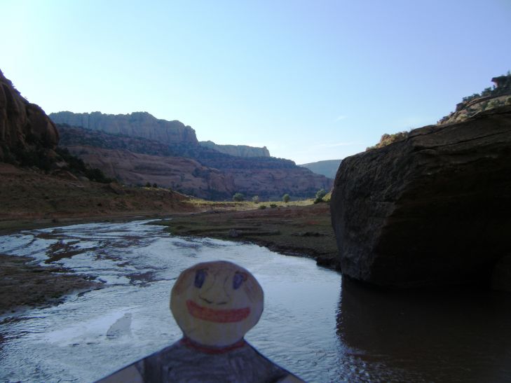
There were a handful of waterfalls to see along the way to the ruins. Did I mention that this was a river valley? Yeah, I had to cross the river probably about 20 times to get out there.


There were some cool sights along the way to keep things interesting, like this rock wall which looks like it could have inspired a cubist painter.


And this layered sandstone formation which looked similar to what you find in shale.


There was natural beauty all around, from flowers to the colorful rock layers.


OK, so here I am at the entrance to the ruins of Keet Seel. It was only about a 11 mile hike. One way! ;-) You can't really see the dwelling, but you can see the alcove in the cliff where they dwelling was built. It was huge!


This composite photo shows the span of the dwelling, roughly 180 feet wide!


Viola! The Keet Seel Ruins! on the right of the photo you see a shear drop off that was about 30 feet high. There was not a real easy was to get up to these dwellings until the National Park Service installed a permanent ladder.


Just think: all of these stones had to be brought up the side of the cliff wall to be assembled into houses. There was no elevator, no ladder, and no real stairs other than small foot-sized ledges carved into the cliff face.


On the wall of the cliff, there were a few paintings. I swear that one looks like a guy with a turkey growing out of his head. :-)


Here you can see a stone which was used for sharpening tools.


Pot shards were all over the place!


Below is a collection of small treasures which the ranger found, including an arrow head, a bone awl, a piece of a fine-beaded necklace, and a piece of rope wrapped with owl feathers.


The construction of the roofing was fairly simple; large sticks, crossed with small sticks, and covered with mud.


These were multi-story dwellings, and tight quarters for sure.


Here you can see the entrance to one of the rooms. There is a half-wall just inside the door which kept incoming drafts from blowing out the cooking fire.


You can tell by the soot on the cliff ceiling that there were quite a few home fires burning.


Here is the underside of a roof, blackened with soot. You can also see some rope made from yucca fibers.


This is a view down into one of the six Kivas at Keet Seel. The Kivas were circular, and had a circular fire pit just inside the doorway. You can imagine the shaman singing some incantation into the chilly night air. The alcove of the cliff was a perfect amphitheater, as even with my tiny, flat lungs I could make such an echoing raucous that I felt twenty times larger! I could just imagine how impressive a shaman's ceremony would be!


Here is a good photo showing a couple different building styles. You can see both walls made of stone as well as walls made from mud applied to upright sticks.


This was the coolest thing I saw on the way back! You'll probably have to click on the image for a larger view, but what you see here is a miniature cliff dwelling! These "ruins" were only about two feet tall, and were probably used by the children of the Anasazi just like doll houses are used by modern kids.


The light is getting dim, and I still have miles to go before I sleep, and miles to go before I sleep. So I better get a move on, so I can rest my tired, wet, wrinkly feet before dark! See you next time!